
.png?width=300&name=creative-intelligence-suite-nav-menu-img%20(1).png)


.png?width=104&height=124&name=Rectangle%201405%20(1).png)
.png?width=104&name=nav-thumbnail%20(2).png)


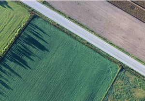
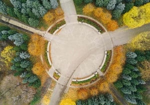
The massive, high-definition imagery used throughout the geospatial industry provides invaluable insights, but huge file sizes can make sharing, viewing, and manipulating this data extremely challenging.
GeoExpress enables geospatial professionals to compress imagery to our proprietary, industry-standard MrSID format. This format supports lossless and visually lossless compression, enabling users to shrink file sizes without sacrificing image quality.
GeoExpress also provides editing capabilities for geospatial imagery compression, so that you can provide improved visual data for analysis. It includes standard imagery editing functionality such as cropping and color balancing, while also enabling you to reproject, mosaic, and more.
Reduce File Size, Maintain Image Quality
Maximize space, optimize usage, and facilitate easier distribution by compressing image files and geospatial data to as much 5% of their original size or cutting file size in half — all while maintaining visual image fidelity.
GeoExpress enables raster compression and LiDAR compression, converting enormous files to MrSID, JPEG 2000, or LAZ formats.
Compressed images are easier to store, access, and share. Their small file size makes them accessible even on mobile devices and in low bandwidth environments.

Customize Your GIS Imagery
GeoExpress provides a comprehensive suite of editing tools that empower you to create the exact image you need. You can:
- Crop, color balance, reproject, and more
- Combine multiple images into seamless mosaic datasets
- Create custom image tiles
- Create MrSID files using your existing GIS imagery and data
- Export only selected sections of imagery you want, at the exact size and resolution you need
Use alpha bands to add true transparency to your imagery.
Integrate Imagery Assets with a Variety of GIS Applications
Industry-standard MrSID format integrates seamlessly with other applications. Process, classify, and interpret your imagery without program compatibility concerns. GeoExpress can be used in combination with nearly all geospatial applications, including ArcGIS, Global Mapper, QGIS, Autodesk, ERDAS, ENVI, SOCET GXP, and Microstation.

Maximize The Value Of Your Assets
More of what you need to easily organize, manage, protect, and share your digital assets
Optimized to create MrSID files, a powerful wavelet-based image format, which is supported in nearly all GIS applications. Built-in pyramids mean MrSID files load almost instantly in most applications.
Create smooth mosaic datasets using intuitive tools. Your mosaic tiles become a seamless single image for use in any application, which remains snappy and responsive.
Automatically adjust brightness, contrast, and gamma, or use manual controls to fine tune adjustments.
Color balance one image, then apply the same changes to all of your other images at once to create consistency across your imagery.
 CROP AND EXPORT IMAGES
Edit your images to the exact size and resolution you need. Extract a specific scene from an image, create customized image tiles, or crop images to match a shape file. Select from preset export options for web and print or create your own.
CROP AND EXPORT IMAGES
Edit your images to the exact size and resolution you need. Extract a specific scene from an image, create customized image tiles, or crop images to match a shape file. Select from preset export options for web and print or create your own.