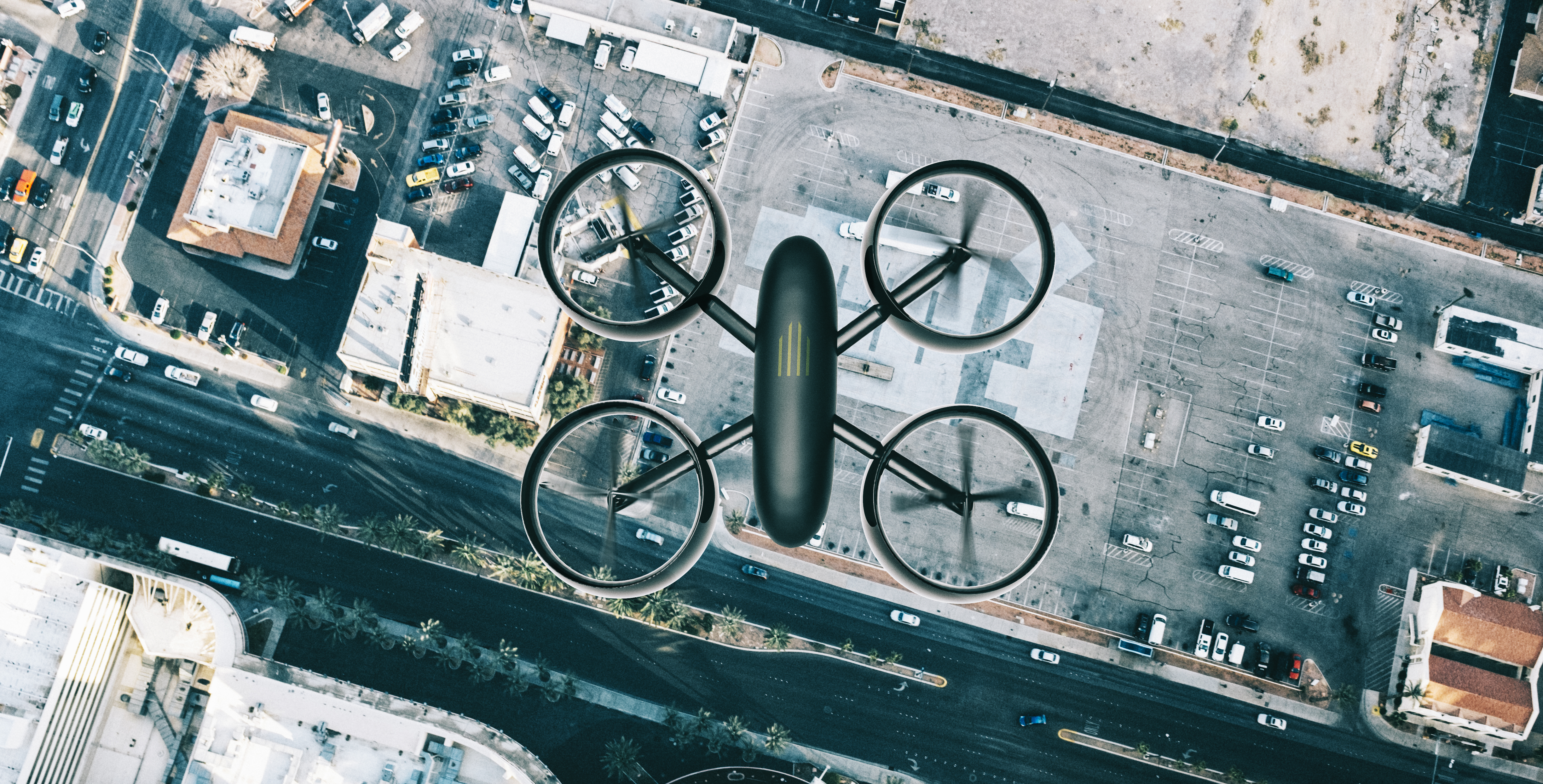
Commercial data collected via Unmanned Aerial Vehicles (UAVs)—typically drones—is becoming more and more popular. “The United States has been a particularly strong source of commercial growth, with the value of drone activity rising from $40 million in 2012 to about $1 billion in 2017.” Usage for commercial drones includes asset management, construction management, real estate, property assessment, as well as disaster response:
However, certain workflows need additional support. Mapping larger areas, or frequent site revisits, result in a massive amount of data collected, which in turn creates a data management headache. This is especially true for collection teams operating remotely and in situations where the collected data needs to be shared with a distributed team of analysts – either via a web-based sharing platform, or simple networked file share. Even short flights result in multiple GBs of data—the higher the camera resolution the greater the amount of data.
Compressing the data into the MrSID image format results in a smaller file with little to no loss of visual quality and no impact on spatial accuracy. From a commercial standpoint, this helps to:
Our own tests conducted for product development reasons have produced remarkable results with drones and their high-resolution cameras, with MrSID compression ratios of up to 200:1 resulting in images with little visual distortion compared to the original. Due in part to the high-quality nature of cameras in most mapping-grade drones, and the relatively low altitude of the flights compared to traditional aerial imagery, MrSID has the potential of taking files of multiple gigabytes down to megabytes. Of course, the higher the quality of the drone camera, the more you will be able to compress it without producing artifacts or distortions.
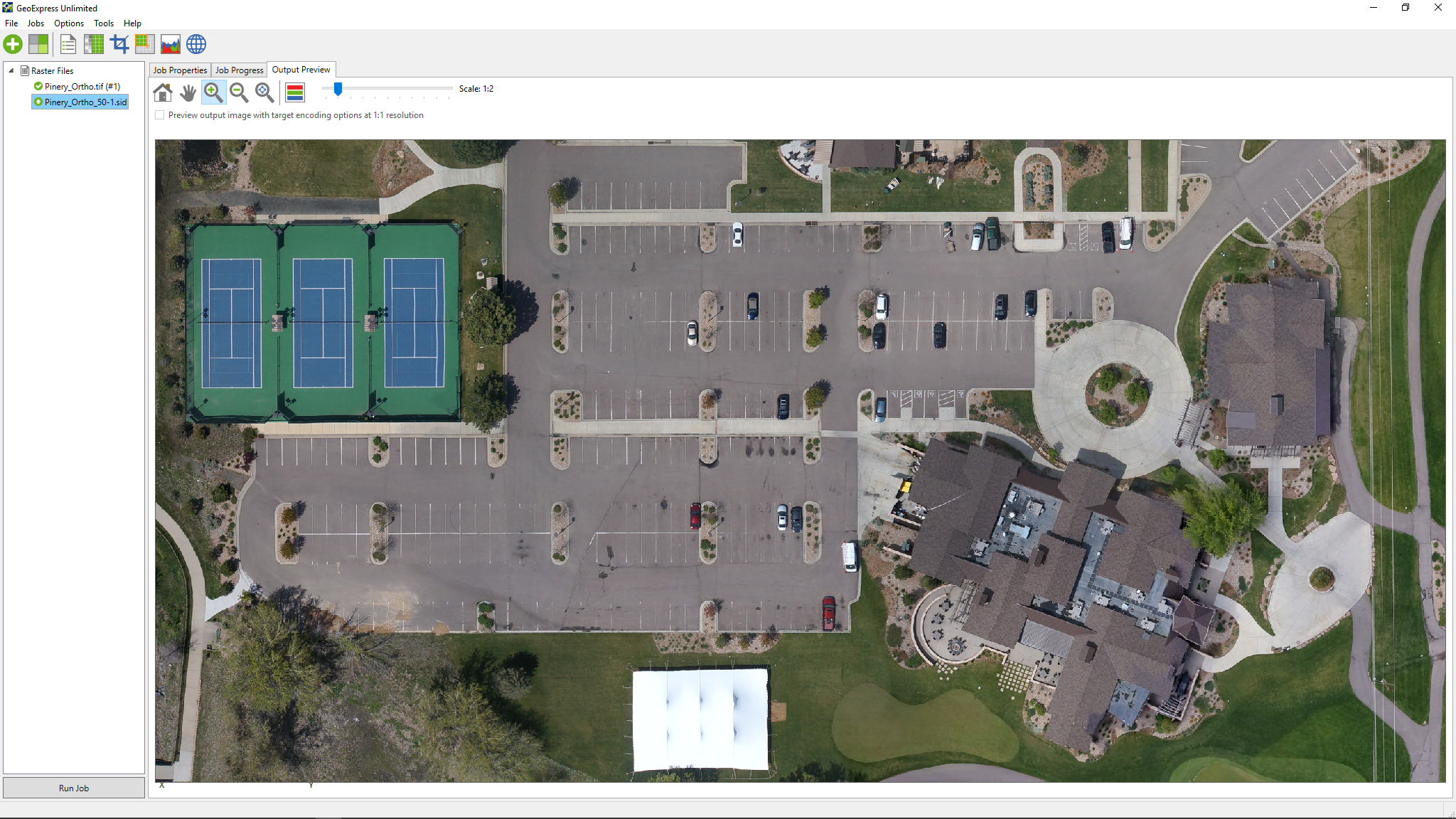
For instance, the imagery below was captured with a Trimble UX5 at 5cm resolution – and provided by our friends at CompassDrone. The image depicts an overheard of a golf course and residential community in Colorado. The image is a raw GeoTIFF of the entire captured area, at 4.7GB.
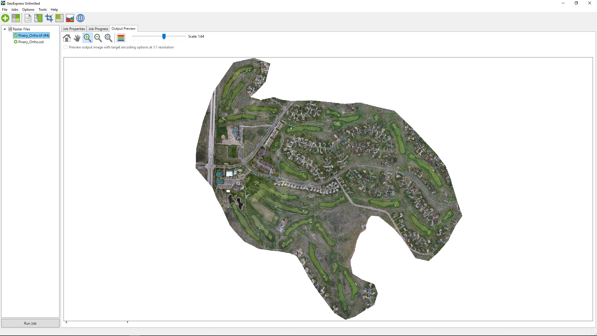
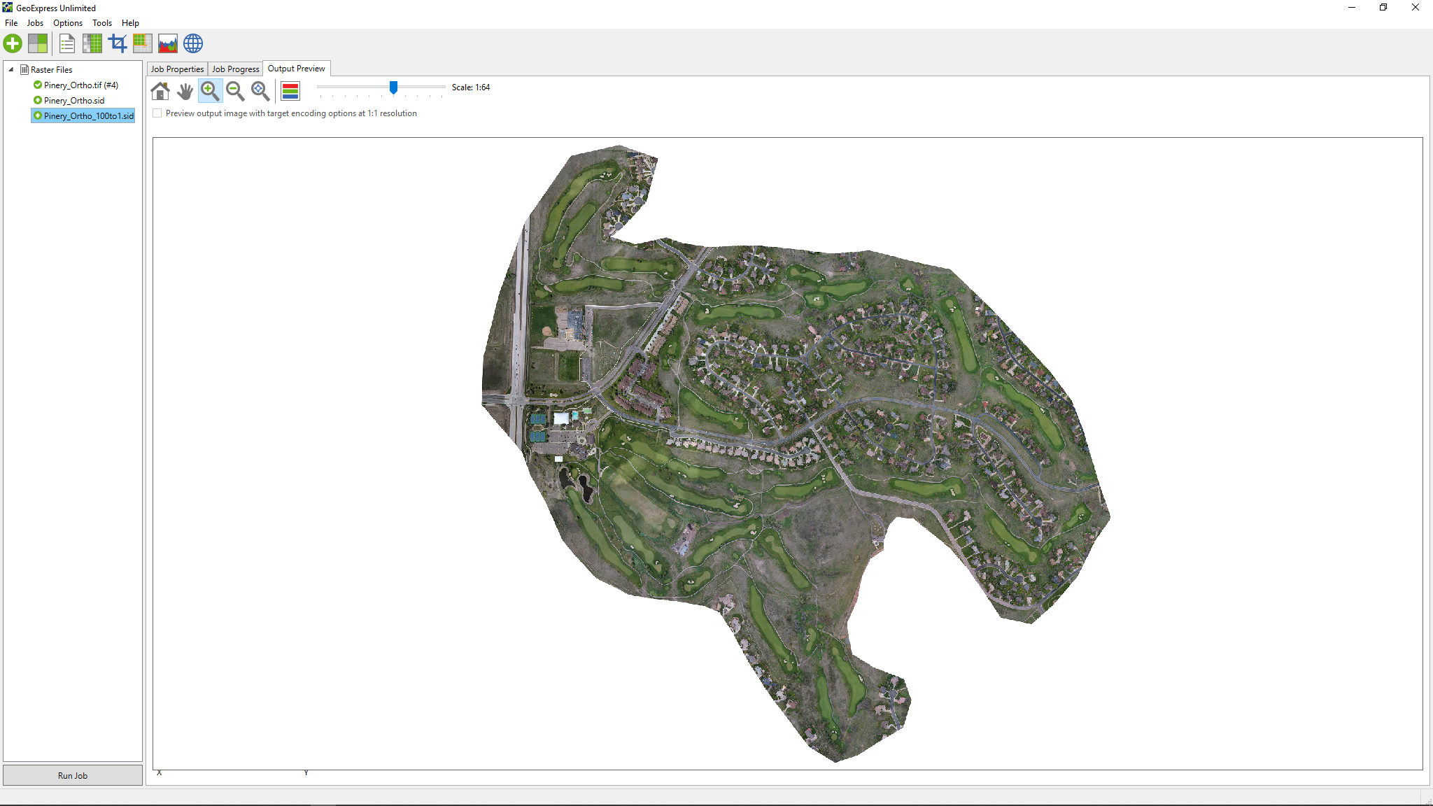
After compressing the entire image into a MrSID at a ratio of 50:1 using GeoExpress, the file size is now 96.9MB. Despite being highly compressed, the clarity and quality of the image is unaffected, allowing us to zoom in and focus on specific areas and still see fine detail.
So, while true lossless compression is available with MrSID, compressing high-resolution drone images even further will produce a visually lossless file. At this level there is a small amount of data loss, but it’s imperceptible to the naked eye. For instance, if we zoom in on the original image we can very clearly see the clubhouse, its parking lot, and adjacent tennis courts.
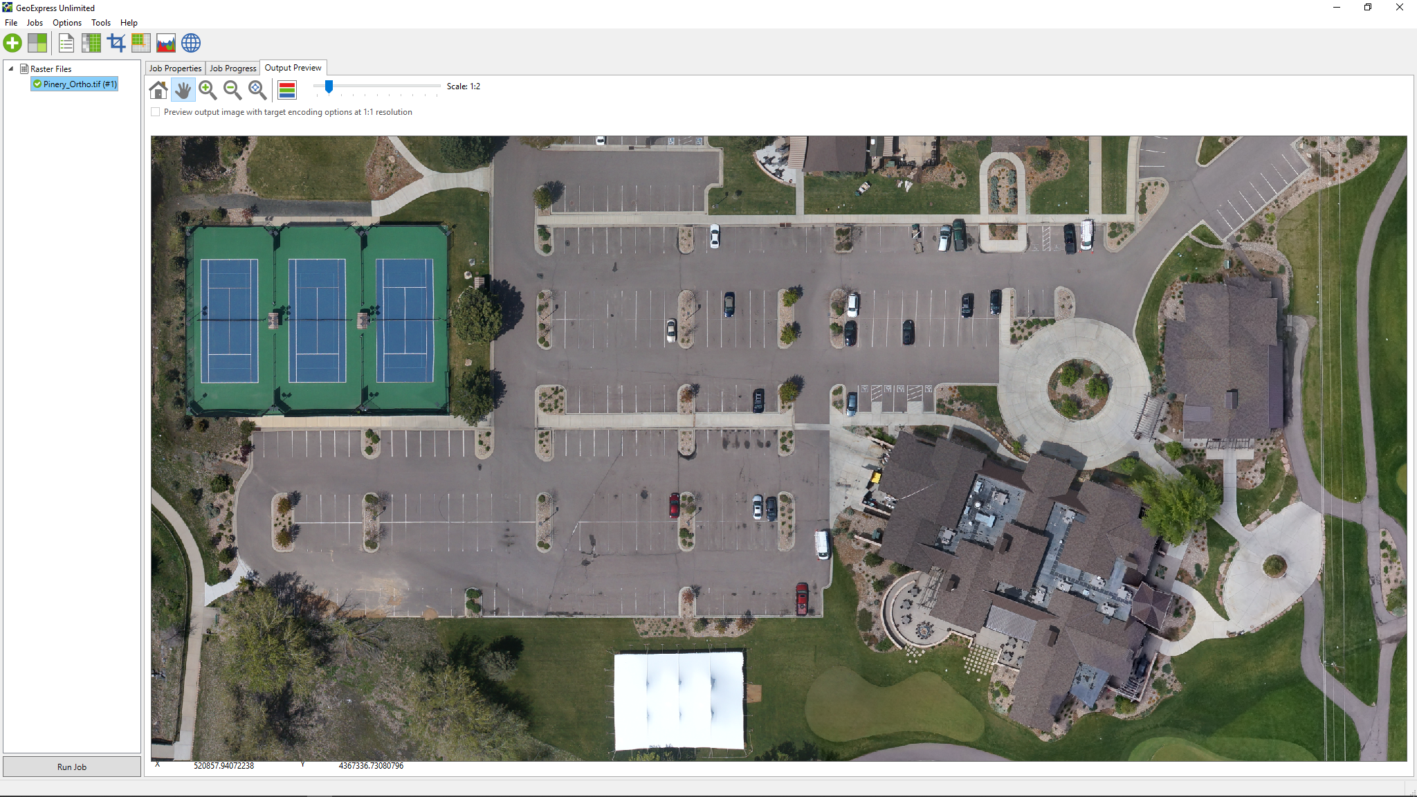
And again, if we zoom into the 50:1 compressed MrSID at 96.9MB, I can still see the detail of the clubhouse and area around it. In fact, it looks almost identical.
This image below shows the level of detail still achievable after we compressed the raw image at a ratio of 150:1, resulting in a file size of 32.3MB. In this view we have zoomed in even closer to show the detail of the roofline of the clubhouse – including the rooftop air conditioning units. This shows you the depth of detail you can achieve with a MrSID compressed file.
< Image 5 >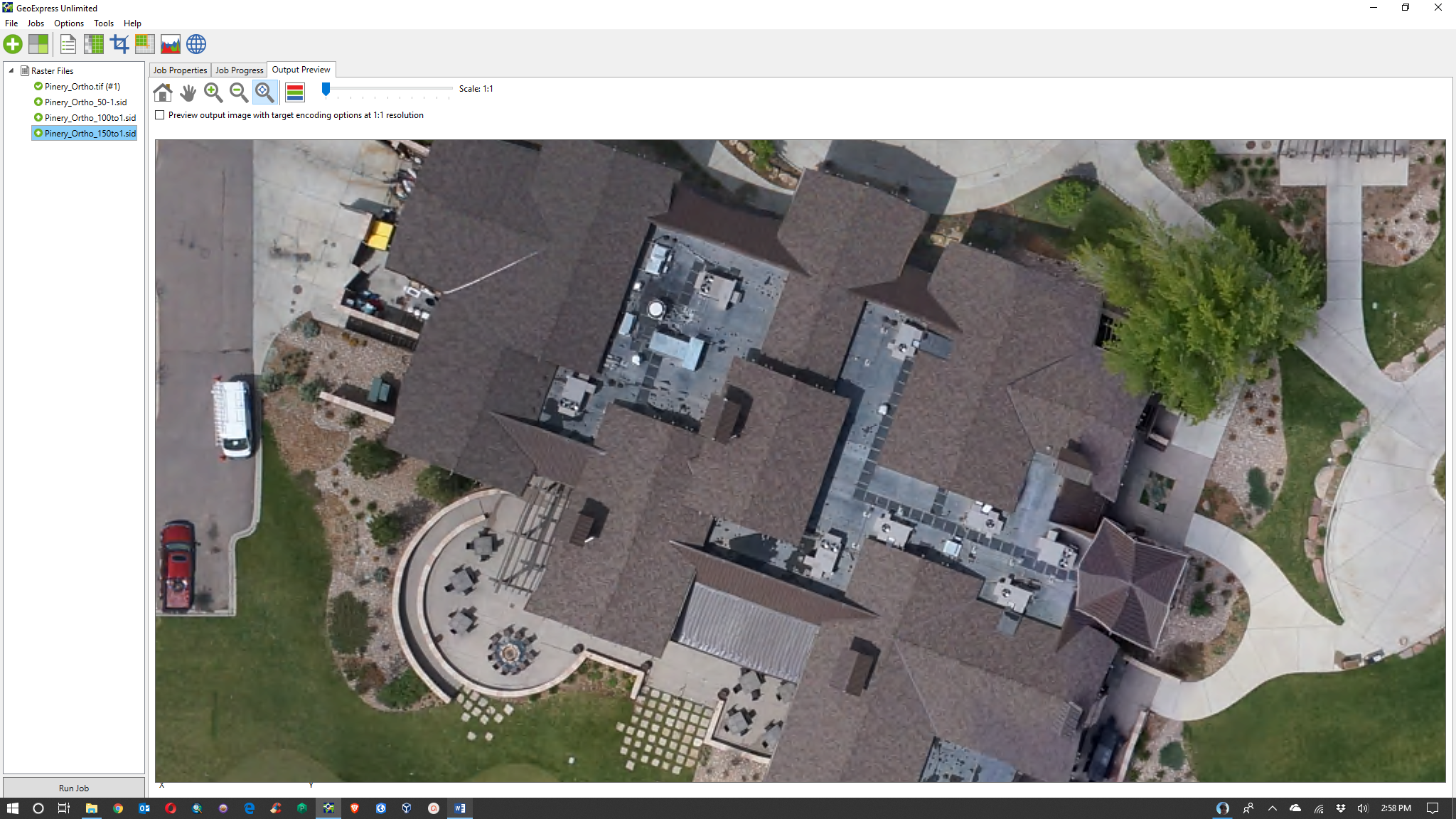
Using MrSID compression technology, your drone imagery can be more easily stored, managed, distributed, and shared. Moreover, you can compress image files to any ratio you require while preserving the ability to zoom in and see fine details.
That’s exactly what the U.S. Army Corp of Engineers needed. After researching better ways to manage their image libraries, they selected Express Server to organize and distribute their MrSID files.